


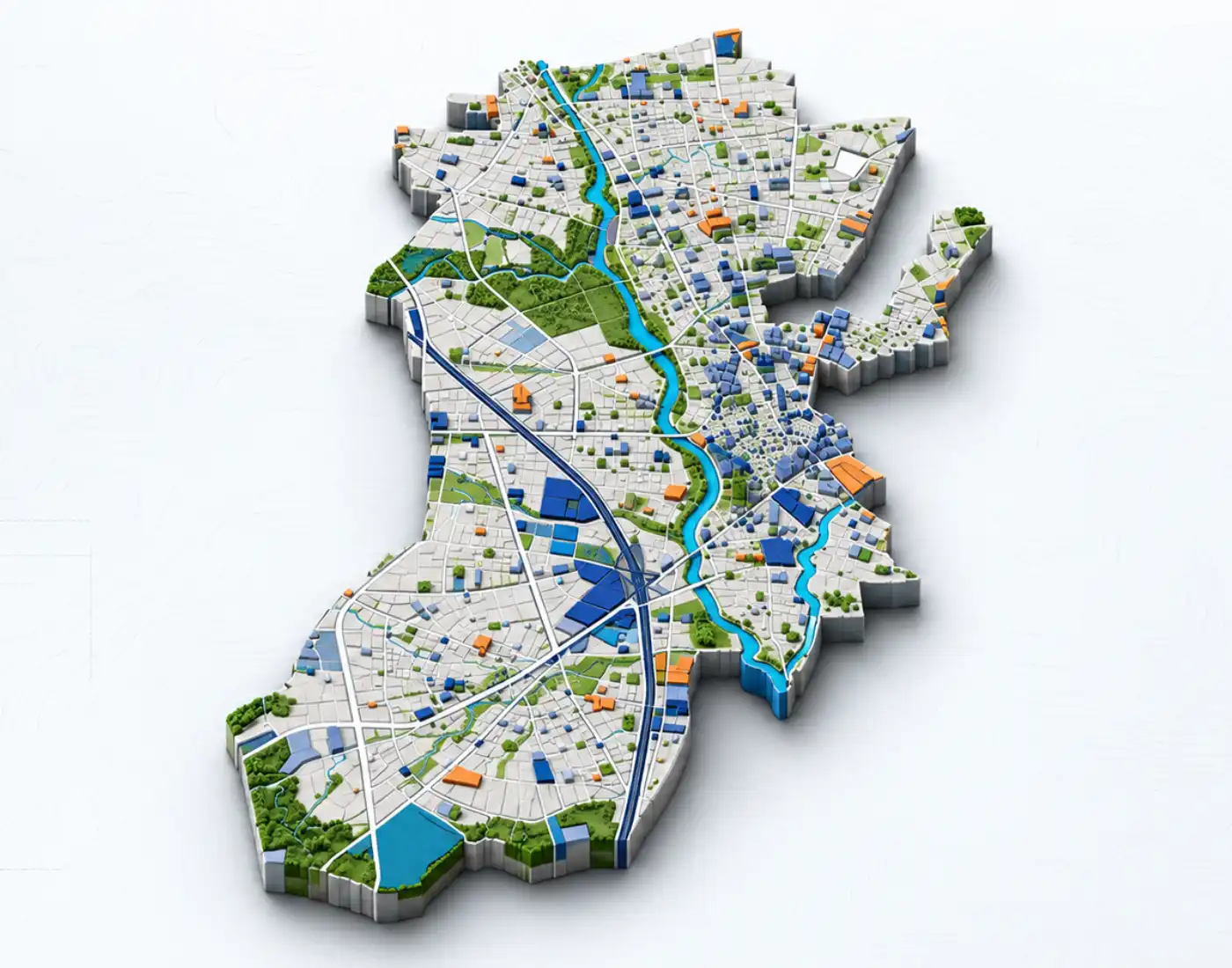
Tejyog Urban Planning — aerial view of planned urban development and infrastructure

Urban & Regional Planning

Urban Planning

Tejyog Urban Planning supports statutory Development Plans, land-use mapping, GIS-based regional planning and technical assistance for State and Local Planning Authorities in Maharashtra and across India.

Urban & Regional Planning Expertise

Tejyog Urban Planning — Development Plans & GIS Solutions

Tejyog Urban Planning brings together statutory planning knowledge, field surveys and geospatial information to help public authorities plan future-ready towns and cities. Based in Nashik, Maharashtra, TEJYOG INFRATECH CONSULTING ENGINEERS PRIVATE LIMITED supports State Town Planning Departments and Urban Local Bodies (ULBs) in understanding existing conditions, preparing planning information and coordinating development proposals.

Our urban and regional planning work addresses Development Plans (DP), Existing Land Use (ELU) surveys, Proposed Land Use (PLU) zoning and Development Control Regulations (DCR). GIS-based spatial information, DGPS surveys and mapping support decisions about land use, transportation networks, public amenities and infrastructure priorities. These inputs help stakeholders assess development opportunities and coordinate technical documentation in line with applicable planning requirements.

Through Tejyog Infra Urban Planning, engineering, mapping and planning teams connect survey findings with practical implementation needs. Organisations seeking Urban Planning Consultants Nashik or Development Plan Consultancy Nashik can explore the company's detailed services and share the scope, location and objectives of a proposed assignment. The emphasis is on verified information, responsible development and planning solutions that can guide long-term urban growth.

Urban and Regional Planning Development Plans
DEVELOPMENT PLAN CONSULTANCY

Urban & Regional Planning

Comprehensive Development Planning & Technical Assistance

Development Plan Consultancy & Authority Advisory

Tejyog Infratech provides specialized consultancy for statutory Development Plans (DP) and technical assistance to State Town Planning Departments and Urban Local Bodies (ULBs). We support local authorities throughout the entire planning lifecycle—from baseline spatial mapping and proposal framing to final statutory sanctioning.

State Town Planning Departments • Urban Local Bodies (ULBs) • Statutory Development Plans

Our Technical Capabilities

Key Service Offerings

Development Plan Components

Statutory Planning

Existing Land Use (ELU) Survey & Base Map Creation

Proposed Land Use (PLU) Zoning & Spatial Allocation

Development Control Regulations (DCR) & Building By-laws

Public Reservation & Utility Allocation

Traffic & Transportation Framework

Infrastructure Gap Analysis
Town Planning & ULB Advisory

Technical Assistance

Technical Assistance in Framing Planning Proposals & DP Reports for ULBs

Scrutiny & Alignment of Proposals with State Policies

Statutory Documentation & Public Objection/Suggestion Support

Capacity Building for ULB Planning Cells

Our Planning Methodology

Development Plan Process

01

Phase 1

Base Map Preparation

DGPS/Drone Boundaries Verification

02

Phase 2

Existing Land Use (ELU)

Field Mapping & Socio-Economic Assessment

03

Phase 3

Spatial Demand Projection

Framing Planning Proposals for ULBs

04

Phase 4

Draft Proposed Land Use (PLU)

DCR Formulation

05

Phase 5

Public Consultation

Public Objections/Suggestions & Technical Scrutiny Support

06

Phase 6

Final Development Plan

Submission & State Sanction Facilitation

Technical Showcase

Data-Driven Spatial Planning

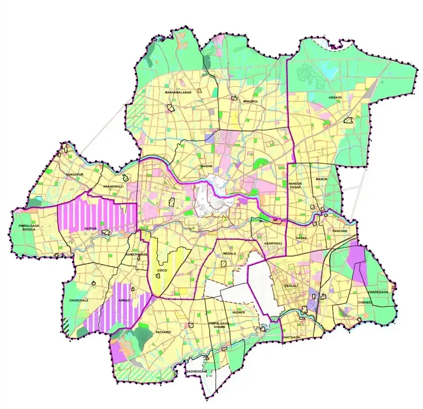
Comprehensive municipal land-use master plan zoning maps and spatial geodatabase overview supporting Development Plan preparation.

Existing Land Use (ELU) Maps
Proposed Land Use (PLU) & Zoning Maps
GIS Geodatabase
Statutory Development Plan Report
Nashik Development Plan - spatial planning map

Development Planning • Spatial Mapping • GIS

Project Documentation & Outputs

Key Deliverables

Base Maps & ELU Maps

Proposed Land Use (PLU) & Zoning Maps

Drafted Planning Proposals

Development Control Regulations (DCR) Document

Statutory Development Plan Report

GIS Geodatabase

Our Project Delivery Flow

DGPS & Base Mapping
ELU Field Survey
Framing Proposals for ULBs
Draft PLU & DCR
Scrutiny & Public Consultation
Final State Sanction Support

Project Enquiry

Let’s Discuss
Your Project.

Tell us what you are planning, where your project is located and the support you require. TEJYOG INFRATECH brings together engineering insight, field intelligence and data-driven planning to understand infrastructure requirements with clarity and purpose.

Survey Analyse Plan Design
Our Location

Nashik, Maharashtra, India

Designing Smarter Cities with Data-Driven Planning.

Tell us about your requirement

Send an Enquiry

Share a few essential details and our team can understand the context of your requirement. Fields marked * are required.

Your details are used only to review and respond to this project enquiry.

Scroll to Top